
This is the other name for this Great Mountain.
Located on the Java Island of Indonesia, it is also the highest strato-volcano on this island.
50 m shorter than Rinjani, but many times tougher to climb.
Standing at 3,676 m, Semeru from a distance looks beautiful and majestic, and on close inspection, it looks even more imposing!
We have climbed
Gunung Rinjani on Lombok, and we thought "what is another volcano", we
have the experience. We were totally wrong!
Prior to the
climb, somehow the authority requires climbers to get letter of
"fitness" from doctor certifying that we are able to climb. So each of
us having to cough up RP 35,000, we went to the clinic on the eve of
Hari Raya Adilfitri, and we didn't get to see the doctor, but a nurse
measured our Blood Pressure and Weight. Worse, the Blood Pressure was taken wrongly, and the weight was written down by us!
Other than contributing RP 35,000, I still am clueless what does that "Letter of Fitness" bought us.
 |
| Gunung Semeru in the background, looking from Gunung Bromo |
 |
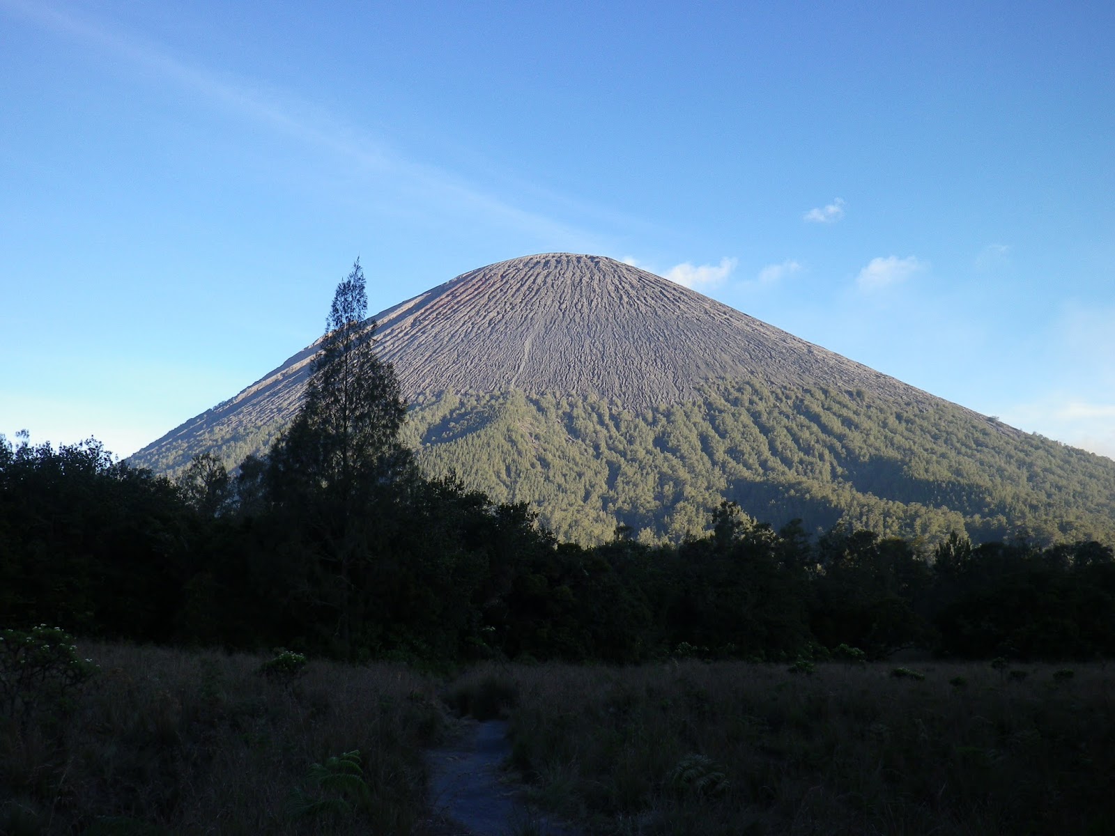
| After passing the
lake, and meadering through the valley, we were presented with this
magnificent view of Gunung Semeru. Observe the treeline, this will be
about 3,200 m; and observe the light colour soil on the face of the volcano (somewhere in the centre), that will be the trail for ascend. |
Ranu Pani Village to Kalimati Campsite
We arrived in this village on the day of Hari Raya Adilfiltri, thus the many flags that are up, and much celebration going on.
Also, the flag
of Red and White symbolises the Indonesian state flag, and soon they
will be celebrating their indenpendence day too.
From Surabaya town it will take about 3 hours of driving to this outpost, also the beginning of the track to Gunung Semeru.
The track from
here to the campsite, will be about 16 km long, with ascent of about 200
m, that is to say, not much gradient. This is good, if you can
consider that we need to warm up those climbing muscles!
 |
| This is the main street in Ranu Pani |
 |
| An unfortunate
Whip Scoprion made its presence felt on the road, after this picture was
taken, the villager fearing that this is a scorpion, promptly squahed
it! What a pity. (Picture courtesy of Loh CH) |
 |
| Along the way, we walked pass this river, with the local going about their daily chore. |
 |
| Beautiful flowers greeted us along the way (a species of Daisy I believe) |
 |
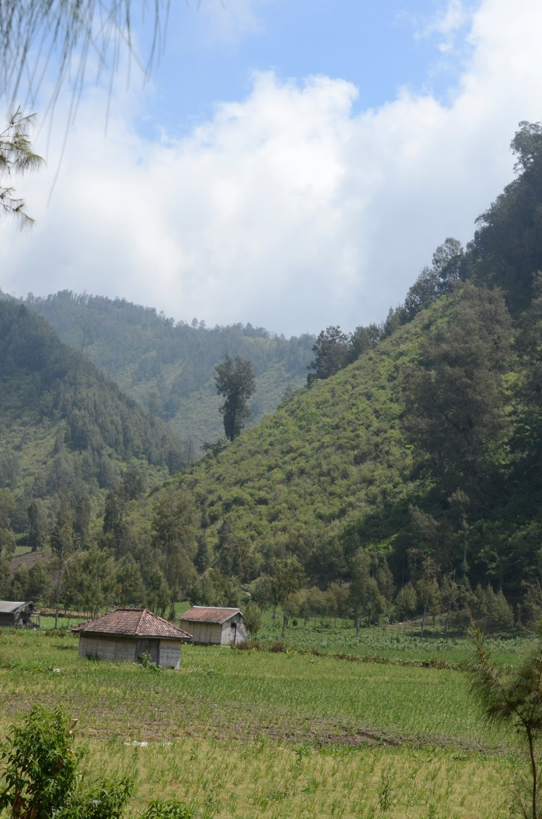
| Farming Village - step terrace for cultivation dotted this landscape |
 |
| The hikers proceeded with their journey after registering for the climb, and with the "Letters of Fitness" |
 |
| Rows and rows of vegetables. |
 |
| Fertile soil - thanks to the volcanic soil |
 |
| Idyllic lifestyle - with no care to the modern day woe, but you still have to worry about the crops and weather |
 |
| At the entrance - this sign said "Selamat Medaki" (Peaceful Climb) |
 |
| Direction sign - our journey to Ranu Kumbolo (the intermediate point where the lake is located) |
 |
| As always at this altitude, the deciduous pine reins supreme. |
 |
| At 2,400 m, there will always be the occasional mist. |
 |
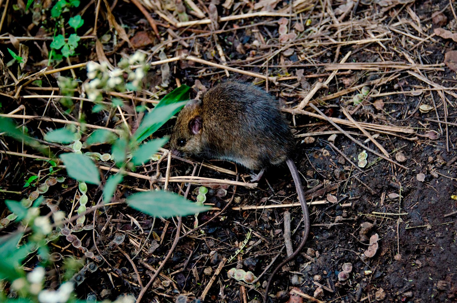
| Along the path, I chanced upon this mouse - either it is so conditioned to human traffic, or I smelt like the jungle! |
 |
| A living tunnel, forms by branches and leaves |
 |
| After an hour plus of walking, Ranu Kumbolo is in sight. This is a big lake, which offers campers water and refuge! |
 |
| To the valley, we will need to descend via this eroded path. |
 |
| And to the edge of the lake |
 |
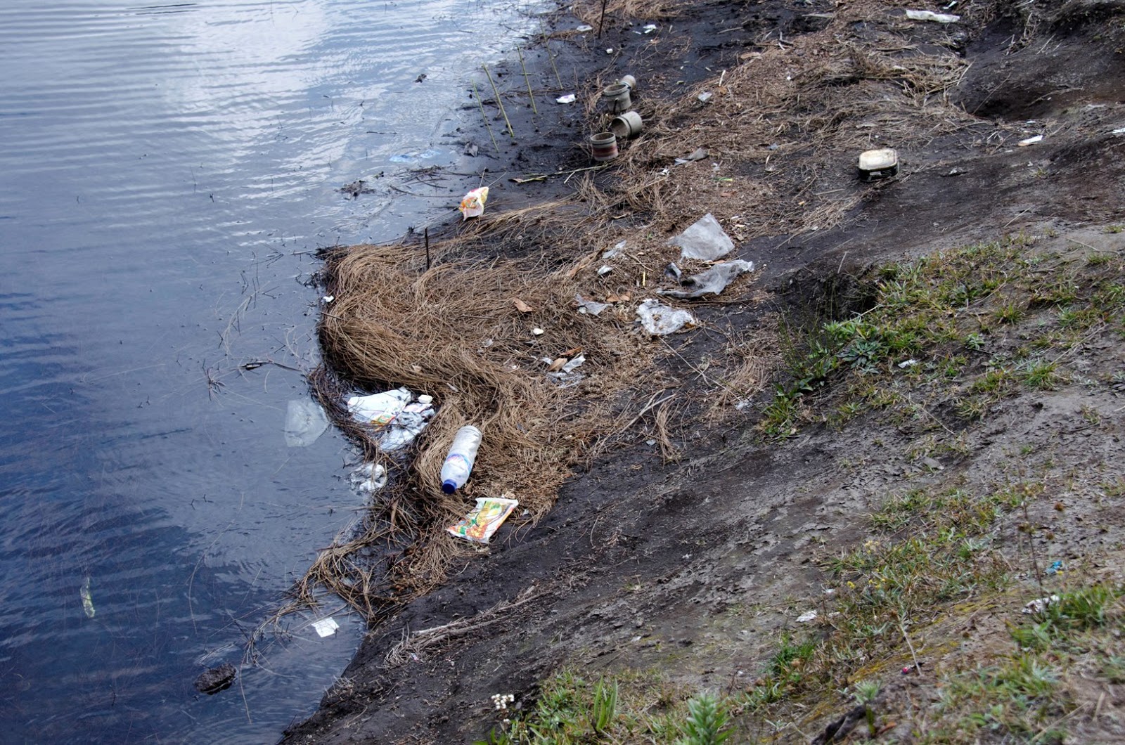
| Only to see careless campers and hikers treating this lake as a convenient dump! |
 |
| We saw fishes thriving in this lake, and many lines and hooks attempting to catch the bigger ones. |
 |
| After the lake, and to the valley floor we will walk, and this time it will be towards the campsite. |
 |
| Tall grasses grow here, and once we walked into the bushes, we were basically dwarfed by these tall shrubs. |
 |
| In this tall bushes, birds make their home. Not too sure what species is this? |
 |
| Another sign - our first leg is coming to a close. |
 |
| Beautiful Semeru is now before us - and I wonder how are we going to make that climb! |
 |
| Add caption |
 |
| The shape changes as we get nearer |
Kalimati Campsite to the Summit and back to Campsite and Ranu Pani
Awaken at 01:30
hr, and with a simple breadfast, we started our climb at 02:30 hr. We
were told that it will take us about 1.5 hours to reach the treeline,
and then another 1.5 hours to the summit, so that we can view the sun
rise.
 |
| So with headlamp and cautious anticipation, we started our climb (Picture courtesy of Loh CH) |
 |
| We trod and trod, and we were still in the tree line ((Picture courtesy of Loh CH) |
 |
| We didn't realise
that we have passed the treeline - after all it was so dark, but then
on this slope, the sun is about to rise. 3 hours from campsite to
summit, this timing must be for the super fit. |
 |
| Tired and exhausted, we plodded on. To be rewarded with this beautiful sight of Sea of Cloud |
 |
| At higher ISO,
and you can see the struggle just to climb. here, a fellow trekker with
the aid of the local, was being helped along. |
 |
| There will be
many pit stops for it was a grueling climb. Imagine if you have to walk
on the sand, and your feet cannot find any good grip for traction,
compound this with a steep gradient, and you can imagine that for every 3
steps up, you may end up with 2 steps down. And many of us, have got
stuck in places that we just simply cannot move up. |
 |
Oh well, might as well appreciate the beautiful sunrise since we are stuck!
 |
 |
| Finally, oh
finally - at 09:00 hr, the last 2 climbers were up. Of the 15 of us
that set forth, 1 fell sick, and stayed in the camp, and 3 got stuck
going up, and thus there were 11. 11 happy souls felt so triumph for
managing to reach the summit, and on this day "Singapore National Day
2013" What do you do when you have reached after an arduous climb, and
moreover it was Singapore National Day - that is right, we recite the
pledge. Reminder of how, tiny Singapore struggled to become a First
Class Country from independence in 1959 and separation in 1965. |
 |
| A view from the top before we start our descend. |
 |
| Preparation for a tough journey down - tough as our muscles are now so spent, from the ascend. |
 |
| Soil is loose, and slope is steep, but hey it beats climbing up! |
 |
| Along the way, we picked up one of our stragglers, a pity for he was just a mere 30 m to the summit! |
 |
| See the soil, loose like sand. |
 |
| Downward journey - it was like snow skiing - except this was sand. |
 |
| Now that we can see better in daylight, we wonder how we managed to climb to the summit in the night. Amazing! |
 |
| After our lunch,
we started our journey back to the village. A backward look to the
mountain, that we have decided to name - the Greatest Volcano that we
have ever climbed. |
 |
| Slowly we walked,
and now we can appreciate the beautiful sight that we have missed, as
we, the day before, tried to reach the camp before the last light. |
 |
| Another view of Semeru. |
 |
| The return journey, with the lake on the left. |
 |
| Beautiful flowers dotted our way |
Epilogue
On hind sight,
for such a mountain, we should have given more time, but we were trying
to take advantage of the long weekend, and everything was done within 5
days. After the climb, we were attempted Gunung Bromo on a 4 by 4, to
view the sunrise.
This was one whirlwind climb; and for our record - Semeru surpassed Rinjani on the toughness scale.
from : http://mountain-n-sea.blogspot.com/2013/08/puncak-mahameru-great-mountain.html


0 komentar:
Posting Komentar